
Independence Township ZIP Code Coverage
Only two postal areas are confirmed by the research for Independence Township. Both use Clarkston as the preferred postal place and both serve portions of the township. Neither a ZIP label nor a Clarkston mailing city proves the municipality for a parcel. Use the United States Postal Service result for the complete address when the delivery area matters. The ZIP code directory begins with that exact-address check.
| ZIP | Areas Covered | Post Office | Notes |
|---|---|---|---|
| 48346 | Clarkston postal area, portions of Independence Township, the incorporated City of the Village of Clarkston, and adjacent delivery area | Clarkston | Exact street-level coverage requires USPS confirmation. |
| 48348 | Clarkston postal area and portions of Independence Township | Clarkston | Clarkston is preferred; Independence is accepted in some ZIP reference data. |
These are delivery geographies, not township boundaries. No official source in the research established a ZIP split, realignment year, ZIP-wide resident count, or a PO-box-only or unique ZIP serving Independence Township. A claim beyond the two confirmed postal areas needs an exact address result from USPS.
Independence Township ZIP Labels
Independence Charter Township surrounds the separate incorporated City of the Village of Clarkston. The postal identity “Clarkston” therefore spans more than one legal jurisdiction. Store the legal municipality or CVT, parcel situs, mailing city, and ZIP as distinct fields. A property record, deed request, permit inquiry, or election question can go to the wrong custodian when those fields are treated as the same thing.
Township office addresses show why care is necessary. One county directory places the township office in 48347, while local sheriff and election pages use 48346. Research did not confirm a township residential delivery range in 48347. Do not generalize an office mailing ZIP to a home, and do not add it to a resident result without the full USPS address lookup.
Verify Independence Township ZIPs
The USPS ZIP Lookup accepts a residential or business street address, city, and state, then returns a standardized address with ZIP and ZIP+4 information. Use the full street number. Searching only for Clarkston or a ZIP number cannot validate a particular address. USPS also cautions that a displayed business address may not be the actual physical location, which is another reason to compare postal and parcel data.
The lookup is the operational postal check for this address workflow. Use it before a parcel search, a records request, or a historical-label comparison.
- Enter the complete street number and street name, with the city and Michigan selected.
- Record USPS’s standardized city, five-digit ZIP, and ZIP+4 without replacing the property’s legal municipality.
- Search the normalized address or its 10-digit PIN in county and township property tools.
- For an older deed or directory, preserve its original route, Clarkston, Independence, or road label beside the modern postal result.
Note: USPS validation confirms delivery formatting. It does not prove ownership, occupancy, township jurisdiction, or a person’s connection to an address.
Map Independence Township ZIP Areas
The Michigan DTMB static-map directory is a useful state map reference for the 48346 and 48348 labels. It is not an official street-boundary source. The research specifically warns against using a general map as the final answer for a delivery address, so keep USPS as the validation step.
The state’s static-map reference provides broad visual context for the Independence Township postal area.
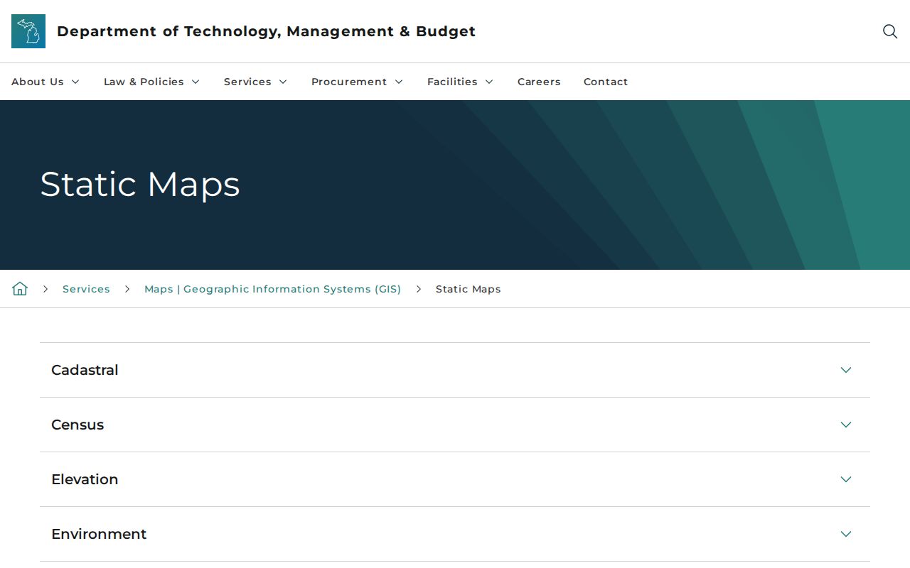
The map gives a broad view of the Clarkston postal area, while address-level USPS output supplies the delivery result that a record search should carry forward.
Use Independence Township ZIP Layers
Oakland County’s Enterprise GIS service includes a Zip Code Area layer along with municipal, voting-precinct, school, and tax-district layers. Use these layers to understand the geography around a known parcel. They are reference geography, not a USPS delivery validator and not a directory of people.
The Enterprise GIS layer list shows why multiple boundaries may cross the same Independence Township address.
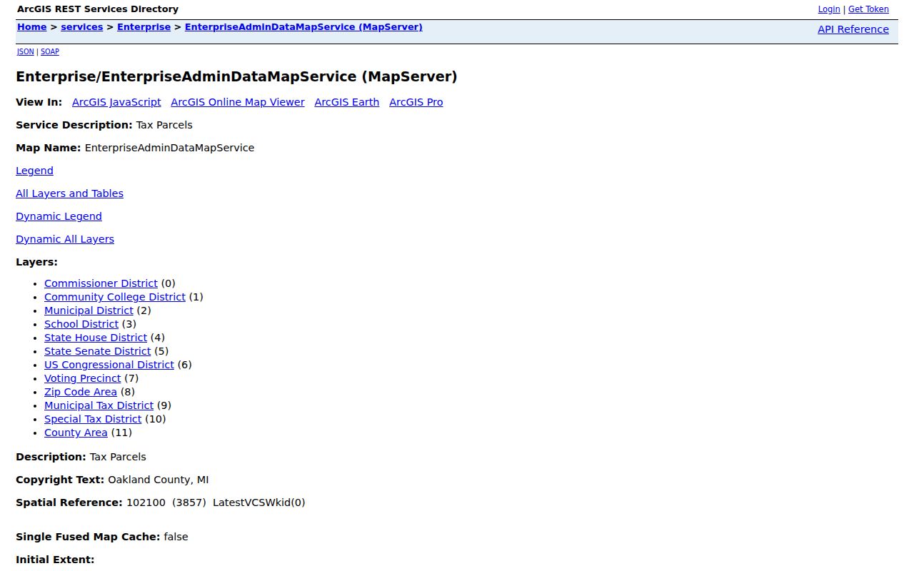
Comparing the ZIP, municipal, precinct, school, and tax layers helps explain differing labels in records without turning any overlay into a people search.
Search Independence Township ZIPs
County and township property portals do not provide a confirmed ZIP-wide resident result. Property Gateway requires at least five characters and accepts a partial or wildcard address or a PIN. Its captured landing page searches by address or PIN, not by ZIP-only residents. Independence Township’s BS&A offers address, name, and PIN modes; the research did not locate a ZIP-result mode there either.
| Portal field | Supported input | Practical use |
|---|---|---|
| Property Gateway | Address or 10-digit PIN, five-character minimum, partial or wildcard allowed | Locate a parcel after exact postal validation |
| BS&A Online | Address, name, or parcel number | Open assessing, tax, sale, permit, and special-assessment records where published |
| Enterprise GIS | Map layers and a known parcel context | Compare ZIP area with municipal, precinct, school, and tax geography |
MYTH. Property Gateway is not a ZIP people search. A ZIP helps orient an address, but the workable county search keys are an address or PIN.
Find Records in Township ZIPs
Use a ZIP as a geographic starting point, then narrow to a specific address. This avoids overstating what the public property, GIS, or voter services can show. The Michigan Voter Information Center requires a person’s own residential street number, street name, city, state, and ZIP; it is not a method for listing everyone in 48346 or 48348.
- Confirm the complete address through USPS and retain ZIP+4 when returned.
- Check the parcel’s municipal, ZIP, precinct, school, and tax-district layers in Enterprise GIS.
- Use the address or 10-digit PIN in Property Gateway or BS&A for the relevant parcel record.
- When the work becomes street-specific, use the By Street directory for the parcel, deed, and historical-address trail.
This postal workflow is strongest when it narrows a question to the right address and jurisdiction. Ownership and residency remain separate questions with their own custodians and limits.
Independence Township ZIP Limits
A ZIP code is a postal delivery geography. Independence Township is the legal charter township, while Clarkston is the preferred mailing city for both confirmed postal areas and the City of the Village of Clarkston is autonomous. A deed, permit, or voter record should be checked against the parcel’s legal municipality, not inferred from the postal city name.
- ZIP versus ZIP+4
- The five-digit ZIP identifies a broad postal delivery area. ZIP+4 adds a more specific delivery segment for the exact standardized address.
- PO-box ZIP
- A ZIP assigned for post-office boxes instead of ordinary street delivery. No such Independence Township ZIP was confirmed in the research.
- Unique ZIP
- A ZIP assigned to a single high-volume organization. No unique ZIP serving Independence Township was found in the official research.
- Carrier route
- A USPS delivery route grouping that can help mail operations but is not a municipal boundary or household list.
Old Independence Township ZIP Forms
Postal and street forms change over time. The Saginaw Trail became Dixie Highway, M-15 runs as Main Street through Clarkston, and I-75 arrived in 1962 as subdivision and commercial growth changed the township’s address patterns. An older directory, deed, permit, or obituary may use Clarkston, Independence, a rural route, or an old road form instead of a modern ZIP.
Oakland’s 10-digit PIN is the durable bridge between address, GIS, tax, and deed systems. When an address will not match, preserve the older wording, compare the legal description, lot and block or section-town-range, and use the 1908 and later maps or historic survey rather than guessing a conversion. The 1996 Independence Fire Department street-address map is a documented historical reference, but no township-wide renumbering schedule was found.
Independence Township ZIP Directory Limits
A useful Independence Township ZIP code directory records what a source actually confirms. The research did not locate an official township-wide ZIP resident count, a voter count by ZIP, an exact street-by-street polygon published by USPS, or a documented local ZIP realignment year. It also did not locate a ZIP-only search field in either Property Gateway or the township BS&A system. Those gaps matter. Filling them with a broad postal lookup would turn a delivery label into a claim about people or legal boundaries that the source does not make.
For a historical address, retain the spelling and postal form found in the original document. A 1912 telephone directory may organize the area by Clarkston or a county community. A 1954 address directory, the 1957, 1958, and 1960 North Oakland criss-cross editions, and the 1967-68 Bresser cross-index are dated address leads, not ZIP lists. Compare the original directory entry with an address, parcel PIN, legal description, and modern USPS result. That preserves the older evidence without forcing it into a postal format that did not exist at the time.
When a postal result and a government office listing seem to conflict, ask the appropriate custodian which field controls the request. The county GIS municipal layer answers the local-government question, USPS answers delivery formatting, and the deed or tax record supplies its own dated land description. Keeping those roles separate is the most reliable way to use ZIP information around Independence Township.
Note: Do not treat a current ZIP code as proof that an older directory or deed used the same postal geography.