
Trace an Independence Township Street Directory
Address work in Independence Charter Township is a record trail, not a one-click answer about every person at a number. First confirm that the parcel is in the township rather than the independent City of the Village of Clarkston. Then use the address to capture the county PIN, the township tax record, and the legal description. The PIN is a unique 10-digit county parcel identifier. It is the bridge that makes a street directory search more reliable when road labels, postal place names, or subdivision layouts do not match.
- Enter the address in Oakland Property Gateway or Independence BS&A. Record the situs address, municipal label, 10-digit PIN, and legal description before moving to another system.
- Use the BS&A assessing result to identify the owner or taxpayer of record. Keep its mailing address in a separate note rather than treating it as a residence field.
- Search the owner, PIN, legal description, or address in the Oakland County Super Index. Open the purchase deed and note the grantor, grantee, recording date, and document number.
- For a person checking their own election information, use the address in Michigan Voter Information Center. Its ordinary screen is personal and address-based, not a street-wide roster.
- For a dated household lead, consult the local reverse directories, then confirm the name in their alphabetical section and a separate official or historical record.
Each step answers a narrower question. The map identifies a parcel, the assessment record identifies a tax role, the deed identifies recorded parties, and a dated directory can identify an earlier address listing. Keeping that separation prevents a street-by-street search from overstating what the records prove.
Search Independence Township Parcels by Address
Oakland County Property Gateway starts with a PIN or property address, not an owner-name field. It accepts at least five characters, partial entries, and wildcard searches, which helps when a direction or road suffix differs from the form on hand. Its map click can then open the parcel context. Independence Township's BS&A Online portal is the better first screen when the known item is an owner name. It offers All Records, Assessing, Building Department, Tax, Utility Billing, sales, and special-assessment paths, with Address, Name, and Parcel Number search choices.
| Portal field or mode | Use in an address search | Format or limit |
|---|---|---|
| Property Gateway PIN | Find a parcel or map/report context | Partial and wildcard searching; five-character minimum |
| Property Gateway property address | Locate a street-number match | Partial and wildcard searching; map click available |
| BS&A Address | Search local assessing, tax, building, utility, and receivable records | Current screen behavior and historic cutoff were not published |
| BS&A Name | Start from a recorded owner or taxpayer name | Use the portal's detailed record-search paths as needed |
| BS&A Parcel Number | Return to the same property after obtaining its PIN | Use the county parcel identifier shown by the official record |
The BS&A screen does not establish an online historical cutoff in the available source material. If a building, assessment, or tax record is missing, preserve the street address, PIN, and date range for an existing-record request rather than assuming the parcel has no file.
The Independence BS&A search screen shows the local record categories and its address, name, and parcel routes.
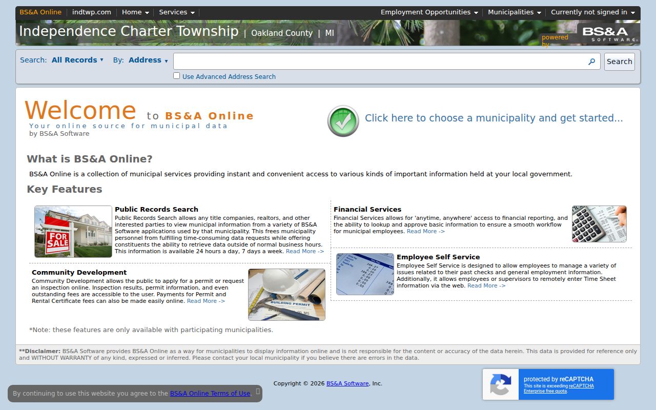
Use the category that matches the question, such as Assessing for a tax record or Building Department for a permit trail, rather than assuming the first result covers every local file.
Keep Independence Township Address Fields Separate
Independence Township surrounds the independent City of the Village of Clarkston. Both 48346 and 48348 use Clarkston as the preferred postal place for portions of the township area. A county office listing may show 48347, but research did not verify it as a township residential ZIP. Store the legal municipality, postal city, situs address, and ZIP in separate fields. The legal municipality determines the custodian. The postal city helps normalize a search. The situs identifies where the land lies.
- Parcel or PIN
- Oakland County's unique 10-digit identifier tying a property to map, tax, deed, and report records.
- Situs address
- The physical location of the parcel used in map and tax context.
- Plat
- A recorded subdivision map showing lots, blocks, and common boundaries.
- Criss-cross directory
- A reverse directory arranged from street address to a dated occupant or business entry.
A mailing address is simply the tax correspondence destination. It may be a post-office box, an agent, a trust contact, or a former address. It is not situs and it does not prove current occupancy. A principal-residence exemption may offer tax-year context for owner occupancy, but it is not a live household confirmation.
Note: Use the municipality on the parcel record before directing a local permit, clerk, or cemetery question to a township office.
Map an Independence Township Street by PIN
Property Gateway provides the geometry. Search a partial address or PIN, select the parcel polygon, and write down its Key PIN. Pan along the road, click the next polygon, and record that parcel's PIN separately. This method is safer than guessing from a similar mailing address. A lake, road, easement, private drive, common area, or irregular tract can make parcels look related when their legal boundaries say otherwise.
Oakland's Enterprise GIS service includes municipal, ZIP Code Area, voting precinct, school district, and tax-district layers. Those overlays help check geography and boundary lines. They are not a voter list, an owner list, or proof that somebody lives at a parcel. For every selected polygon, open the linked property report or township assessment record to identify the recorded owner.
The Property Gateway search page illustrates the county's PIN-or-address starting point and partial-search guidance.
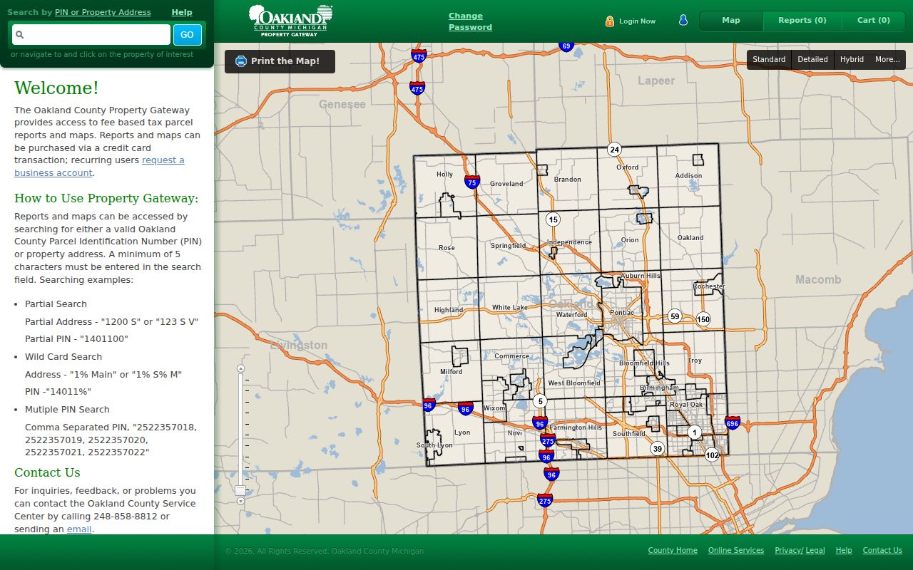
Map browsing produces a parcel sequence for a street directory; ownership still comes from the record linked to each selected parcel.
Compare Independence Township Street Records
Several custodians hold address-keyed material, and the records work best together. The assessment record can connect a PIN to owner or taxpayer information. GIS adds boundaries and administrative layers. The Register of Deeds holds the actual recorded land instruments. A permit may date an alteration. Historical directories and census sources add dated household clues. No single Independence Township street directory substitutes for all of them.
| Address record | What it can establish | Access route |
|---|---|---|
| BS&A assessing or tax record | Owner or taxpayer, PIN, situs, mailing field, values, sales, and exemptions when present | Address, name, or PIN online; township office or FOIA fallback |
| Property Gateway and GIS | Parcel geometry, map context, PIN, aerial, flood, ZIP, precinct, school, and municipal layers | Free map basics; some reports or map products may cost |
| Recorded deed, mortgage, or lien | Recorded parties, instrument, date, consideration when available, and legal description | Super Index online from 1964; older manual and county records |
| Township building record | Public permit, work, inspection timing, applicant, or contractor fields where available | BS&A search; address-and-date FOIA request for older existing files |
| Reverse directory | A dated address-to-name or business lead | OCHS, library, and historical collections in person |
For an older street, retain the lot, block, plat, or section-town-range as well as the address. If a parcel has been split, combined, or replatted, the current PIN may not be the best backward key. The legal description can carry the trail across that change.
Follow Independence Township Deed Parties
The Oakland County Super Index is the recorded-land route after the parcel is identified. It provides a free index and document database from January 1, 1964 to the present. Search by a party name, address, PIN, subdivision, document number, or liber and page. The purchase deed usually names the current owner as grantee and the seller as grantor. Search that seller as an earlier grantee to work backward through the chain.
A recorded deed is stronger than a sale field for title history. Preserve the recording date, document number, parties, and legal description before making the next search. For pre-1964 material, Oakland County's manual grantor-grantee and tract indexes, deed books, Records Retention, and staff assistance remain the appropriate path. The tract-index service assists in person or by mail; copies are $1 per page and certification is $5.
Oakland County Super Index is the official online starting point for the post-1963 recorded-document chain.
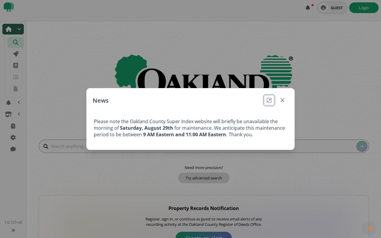
The index can identify a recorded instrument, while a deed image or ordered copy supplies the document details needed to verify the chain.
Check Independence Township Address Files
BS&A includes Building Department Record Search, permit application, and inspection options. A public permit record can help bracket construction, an addition, or an alteration, but a permit is not a resident record and does not establish who remained at an address. The published research did not locate a complete field list or an earliest online permit year for the township.
When the online record is incomplete, request an existing historical permit, inspection log, or code file from the township by street address, PIN, and date range. Michigan Freedom of Information Act, 1976 PA 442, MCL 15.231 et seq., applies to a sufficiently described existing record. The township has five business days to respond and may issue a written ten-business-day extension. It does not have to create a new summary or ownership history.
Use Independence Township Voter Tools Carefully
Michigan Voter Information Center takes a residential street number, street name, city, state, and ZIP to provide personalized voter information. It is appropriate for a person checking their own status, precinct, ballot, or clerk information. It is not a browse-all screen for an Independence Township street directory. Michigan voters do not register by party, and ballot choices are not public voter data.
The public version of Michigan's Qualified Voter File is a separate official request channel. Sensitive identifiers and protected records are withheld, including Address Confidentiality Program information. For historical poll books or registration records, the published research did not find an Independence-specific online run. Ask the township clerk, Oakland County Clerk, library, Oakland County Historical Society, or Oakland County Genealogical Society for the applicable dated holdings.
Note: A precinct overlay describes an administrative area, not the identities or personal details of people who may be registered there.
Read Independence Township Street Directories by Year
The Oakland County Historical Society shelf list identifies a practical set of address sources: a South Oakland Address Telephone Directory from 1954, North Oakland criss-cross volumes from 1957, 1958, and 1960, plus Bresser's South Oakland Cross-Index from 1967–68. The 1912 Oakland County telephone directory includes Clarkston among its communities. These are useful dated snapshots, not claims that every Independence road or household appears.
Begin with the street section, copy the edition, year, and page, then locate the same name in the alphabetical section. Rural-route, post-office, and county-area labels can vary from a modern street address. The historic directory collections are described in more depth in the Independence Township city directories.
Bridge Older Independence Township Street Forms
Old and current address forms can diverge here. The Saginaw Trail became Dixie Highway, M-15 runs through Clarkston as Main Street, and I-75 brought later subdivision growth. The Clarkston historic project uses current addresses, historic survey entries, plats, and property-history references. It also preserves a township Fire Department street-address map dated February 14, 1996.
That 1996 map is a helpful bridge, not evidence of a township-wide renumbering date. No official Independence-wide renumbering or street-renaming schedule was found. When an old address will not match a modern search, compare the historic survey, plat, older map, road-name variants, and legal description. Do not invent a number conversion from a superficial match.
Limit Independence Township Street Directory Results
A street search can document parcels and recorded land parties, but it cannot identify everyone attached to a home. It does not open motor-vehicle addresses, utility-customer information, unlisted contacts, protected voter details, Address Confidentiality Program addresses, or informal occupants. A tax field can be stale. A mailing field can belong to an agent or trust. A recorded owner can differ from the person using a property day to day.
If a source seems wrong, preserve its URL, record number, date, and supporting proof, then ask the original custodian about correction. Michigan law also restricts motor-vehicle data under the federal Driver's Privacy Protection Act. The responsible approach is to verify each result with the office that holds it.